|
|
Wilderness uncovered - the past and future of drowned lands |
|
|
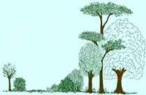
A recent book about the making of the British landscape brought forth a remarkable and unexpected elision of ideas about the human experience of wilderness, at least in its early chapters, as it charts the return of vegetation, animals and people, when the cold receded after the last Ice Age; the processes that then resulted in Britain becoming an island; and the subsequent arrival of agriculture extinguishing the culture of foraging and hunting, as well as clearing the wilderness away in its expansive path. I can trace the elision back as much as seven years, to when I was writing an introduction to a journal article with Rob Pheasant about the effects of sound on the visual perception of landscapes, but it is in more recent correspondence with Steven Robinson about an article he was writing for the “Rewilding” Britain website that the connection with the book was made. I should note that Steven’s article was knocked back by “Rewilding” Britain, but was published as a guest blog by Mark Avery (1). Humans, aurochs and cows Steven wanted to use his article to open up the debate on what “rewilding” has come to mean, fearing that it has been subsumed by the appeal of the cultural trope of herbivore-driven systems so that it is hard any longer to find the wildness in it. Symptomatic of this to Steven was the representation of domestic cattle as functional replacements, when this made very little ecological sense. Thus he posited the question of whether cows were wild, answering it by comparison to what is known about aurochs, the wild but extinct ancestor. Our correspondence revolved around what could be deduced about the probable habitat selection of aurochs, given what’s known about the distribution of fossil bones, and what isotope studies of those bones reveal about their dietary composition. We had trouble with interpreting what isotopes as proxies for habitat selection told us. One paper suggested that on the basis of carbon and nitrogen isotopes, domestic cattle had access to open areas, whereas aurochs fed under tree canopies (2). The problem with that binary is that grass doesn’t grow much in shade, so what were the aurochs eating? It is this contradiction that I also pointed out about another paper, where one figure showed the fixation of carbon deposited in bones was increasingly taking place in shade, whereas another showed a time trend that suggested the aurochs were moving more towards grazing than browsing (3). A further paper showed a clear separation between aurochs and domestic cattle, indicating that Neolithic farming groups exploited environmentally-different areas for their cattle from those used naturally by aurochs (4). In addition, these authors offered a different explanation for interpreting isotope results, arguing that they could have stemmed from plants growing in wetland rather than under a tree canopy, and this is supported by a geo-spatial study of the location of aurochs fossil bones that suggested that the preferred habitat of aurochs was riverine flatland (5). Isotope studies aside, the key issue about the difference between domestic cattle and aurochs during the period that their presence overlapped is that the former were in the control of Neolithic people. I doubt these people were ever able to herd aurochs, whereas the pacified nature of domestic cattle allowed them to be herded where ever was chosen. In terms of nutritional efficiency this would have been in open areas cleared by Neolithic people who would have observed that grass grew better there. Thus their distributions were bound to be different, irrespective of the instinctive habitat selection on the part of aurochs. Steven had seen that different interpretation of isotope results, but he had also read about a contemporary account of the last surviving aurochs in Poland during the 16 century that described the aurochs eating acorns, and branches of bushes and trees in winter (6). This led him to wonder whether this was the result of these aurochs living in a refuge habitat due to persecution and competition from domestic cattle. The argument about woodland being a refuge habitat seemed credible for aurochs in the 16th century, given their competition for resources with domestic cattle, but it is more likely that woodland was a necessity anyway during the colder months, that they would dip into to find any available source of food, even if they weren’t able to efficiently digest it. The winter mortality of Heck cattle on the Oostvaardersplassen, especially when there is snow on the ground, is probably an indication of this now there isn’t even bark to chew on (7). Whether a wild animal was a forest or open landscape species is a stale argument anyway when that simple binary probably rarely ever existed. It’s the in between states of landscape cover that species would have existed in and serially exploited, and which proportionately will have varied on the basis of edaphic and climatic factors. My bias suggests that the matrix, the predominant characteristic of a temperate landscape, would have been woodland at differing densities, from high canopy woodland to scattered trees. Every wild species that we have, or had, in that post-glacial age, could survive in that variety, the relative abundance of species depending on the relative openness. Those animals that were intermediate feeders or browsers would have an edge over those reliant on grasses. Since grasses don’t grow well in shade, and don’t grow at all in the cold and short day length of winter, then herbivores reliant on grass would always be in limited numbers in my version of a wild landscape cover. It may also have been that aurochs sought to avoid Neolithic people and their activities – they were probably hunted for meat to supplement farmed meat - and which again would have created a difference in spatial distribution between cattle and aurochs. At least coming in to the Holocene, predator ability met the challenge of what herbivores there were, and it is that lack of those predators now, rather than any lack of herbivores, which is persecuting landscapes. Life after the Ice Age After all this discussion, Steven noted that there was a gap for a good book on life after the Ice Age, and asked if I was tempted to fill the gap? In reply, I said that I have often thought about writing an article about Doggerland, the area of land existing between the NE coast of Britain across to Denmark and down to the Channel Islands, which warmed to a temperate climate for a few thousand years, but then was inundated when sea levels rose. There is archaeo-ecological evidence from the drowned land around the British coast, such as submerged forests (8) as well as evidence of bones and tree material from across the larger Doggerland area that emerged initially in the mid-19 century from being inadvertent bycatch in trawler nets (9) and from later surveys and core drilling carried out during exploration for oil (10,11). Given that our native species are those regarded as having been trapped as sea levels rose, why is it that our ecological composition is poor compared to continental Europe? Was it a time dependent migration back across Doggerland, the sea level rise halting that process, or were there other factors? Since southern England was not glaciated, but would have been as cold as tundra, how far away from there did you have to go E or SE to find a functioning temperate ecology that could act as a refuge (12)? Has this got something to do with the Lusitanian species, those plant species found in Ireland that are also found on the western edge of Iberia, but not much in Britain (13, 14)? I doubted if I would want to write a whole book about life after the Ice Age, as it would require so much desk study to catch up with what is known, especially about Doggerland. No sooner had I mentioned writing about Doggerland to Steven when an advance review of a book by Nicholas Crane about the making of the British landscape came along, in which it said the book charted the end of the Ice Age and the beginning of Britain being an island, as Doggerland was inundated (15). I ordered it, interested to see how Crane dealt with the Mesolithic. Within a few pages, I began to get the answer, but in the rich detail in which he evokes the interplay between people, animals and the vegetation of the landscapes (16). Amid what he describes as a burgeoning biomass around 9,200BC, while the tundra retreated, horses and reindeer disappeared from southern Britain and were replaced by elk, roe deer, red deer, boar and aurochs. He describes the aurochs as quick, agile and a match for hesitant wolves, their favoured habitat being level, low-lying, fertile and open – “woodland would not have supported the rich grassland they depended upon. Congregating in herds on floodplains and valley floors, they were the biggest beasts in Britain”. It was, however, their "preference for valleys and floodplains that put the herds in conflict with humans who used these landscapes for routeways, foraging and hunting missions". They killed aurochs, which were a source of red meat and raw materials like bone and hide, the bone being used to make scrapers for cleaning hides. Crane sees the eventual demise of the aurochs in Britain as being the most conspicuous casualty of the farming onslaught competing for the low-lying, level, fertile land - “Aurochs took to grazing in surviving tracts of marginal wetland, but eventually they lost this last-chance reserve, too. By around 1350BC, Britain’s largest mammal had been driven to extinction”. This congruence with our deliberations was a pleasing surprise: looking at the back of the book I saw that Crane had read many of the same sources of information. Crane’s evocation of Doggerland, which had at one time been bigger than Britain, was of a low, undulating plain that, before the ice sheet to its north had begun to melt, had been a “cold, arid land of mosses and lichens, sedges, grasses and stunted shrubs that were snow-covered in winter and blasted by frigid, dust-laden winds in summer. Vegetation struggled to reach half a metre in height. Pale clumps of creeping willow, juniper and dwarf birch clung to pockets of soil which had been turned slightly saline by desiccative winds and meagre rainfall” (and see (17) for the extent of ice and tundra). Not much moved across this landscape until around 9700BC when the climate changed, rain fell, perennial wild flowers spread as mats and carpets, and “into this waking land walked some hominids” as an experienced woodland people from more temperate climes (and see (12)) making their passage across Dogglerland to become “newcomers to Britain, with subsistence strategies and tool sets (and presumably beliefs and traditions, too) suited to a warming land scattered with trees — mainly birch and pine — and populated by a diverse flora and fauna”. Thus by the end of the millennium, and with the increasing warmth from the receding ice sheet, elm, oak and lime had returned over Doggerland to grow, along with hazel, in southern England. The birch and pine had moved north into Scotland – “Woodland moved during the course of a human lifetime; on good soils in southern Britain, oak migrated at a rate of 350 to 500 metres a year and pine at 100 to 700 metres a year” Sea levels had begun to rise from melting ice and the thermal expansion of the oceans as long ago as 18,000 BC (18) attacking Doggerland’s coastlines and flooding its productive wetlands, a low watershed connecting continental uplands between the Rhine and the Elbe, with hills between the Thames and the Ouse – you could walk from the source of the Rhine to the source of the Thames without crossing sea. Crane believes that the Doggerland people probably enjoyed greater returns from their foraging, hunting and fishing than in any area of equivalent size in Britain, but as the number of people in Britain rose, the area of Doggerland continued to contract from the rising sea. By 7000BC, the plains and low hills of Doggerland had shrunk to the point where there was only a narrow connecting bridge, but a tsunami around 6000BC was a violent assault over this low-lying land, clearing woodland, and perhaps hundreds of people were swept away and killed (and see (19)). High tides in the North Sea and Channel broke through the bridge and completed the separation of Britain from the continent. It is speculated that there were remnants of Doggerland that survived as shrinking islands in an ever rising sea, and which may have been waypoints and stepping stones for the first few who ventured a sea journey between the continent and Britain (and see (20,21)) but they too were lost as the sea level rose in all by 70 metres. Promise of discoveries unfulfilled The excitement about discoveries from Doggerland lie in the presumption that they will reveal evidence about the hunter gatherers of the Mesolithic and which, if you think about it, has not been over laid or altered by the subsequent dominant modifying effect of Neolithic people and their agriculture. I have to say that the literature about Doggerland hasn’t moved on much since I last looked, and is falling short of that promise (22) one problem being the unknown stratigraphical, palaeogeographical, and archaeological context of much of the existing finds (23). Thus of recent papers published this year, one focussed on the evidence of Pleistocene rather than Holocene fauna, as revealed by investigation of material, mainly from trawling, that has been deposited within museum collections across the UK (24). Another analysed isotopes in Mesolithic human skeletal remains obtained by fishing, dredging, and sand suppletion (capturing sand for beach replenishment and land reclamation) and which showed that inhabitants of Doggerland had a significant component of freshwater fish in their diet, the authors saying that perhaps this indicated that the importance of marine resources of the communities in this drowning area may have been limited, (23) but this seems at odds with the increasing length of coastline and its greater proximity to the hinterland as Doggerland was subsumed by the sea. It is evidence from excavation of the more easily accessible submerged forests on the coast of western Britain, infrequently exposed by storms – such as Goldcliff in the Severn Estuary - that has allowed more informed speculation about the pattern of seasonal occupation of coastal sites during the Mesolithic, and of its faunal composition, vegetative cover, and resource use before it too was lost beneath the sea (8). The morphology of the trees discovered in these drowned forests is given as one argument against the supposition of open landscapes driven by herbivores, as is the likely spatial unevenness of herbivore pressure arising from topographical variability. But for archaeologists, it is the oversight in recognising that beavers were a significant environmental disturbance factor in river valleys and lowlands in prehistory. I wonder how many others would notice the following connection: it was Professor Bryony Coles who first appropriated Dogger Bank, the drowned hill in the North Sea, to name the whole area as Doggerland to emphasise its availability for settlement by prehistoric peoples (25,26) but then Coles has also extensively researched the archaeology of the European Beaver and the effects it had on the landscape and on trees (27). I can’t leave Doggerland without pointing out that drowned lands have been brought up to date in a new graphic novel - A Dream of a Low Carbon Future. This is the story of one particular positive view of the future, designed as a way of illustrating some ideas about climate change and low carbon technologies (28). It came out of a project where schoolchildren worked with PhD students and staff at the Centre for Doctoral Training in Low Carbon Technologies at the University of Leeds. The project chose a 2-3°c global temperature rise that implies catastrophic floods, droughts, loss of wild nature and mass migration, coupled with a 4m sea-level rise by 2150AD. Scenarios of imminent rising sea level are not new, but the visualisation here is novel in that an additional schematic panel dated AD2150 is added to the time sequence of marine inundation of Doggerland that Bryony Coles originally developed (20). This additional panel shows massive incursions inland at the Wash, and along the Severn and Humber estuaries, as well as shrinkage around the coast of Britain. In keeping with the positive outlook, a focus is given to the low-impact communities that settle around the massive length of the new shoreline of the Bay of York, the inland estuary created by sea flooding up the Humber. The Bay itself is designated a National Park and becomes a huge avian sanctuary, the different degrees of salinity creating a choice of habitats for marshland and sea birds. In addition, large areas of the National Park are also designated as strict marine reserves where no fishing is allowed. Traversing a biophysical wilderness Those low-impact communities around the Bay of York while hypothesised have an antecedence in the woodland people described by Crane, the new colonists that crossed Doggerland and began to experience the wilderness that they would have found in a warmed England, exploiting the multiplicity of resources that came with a temperate climate and trees (see above). Crane is clear about a key motivating factor for these colonists, because food sources were not distributed evenly, or throughout the year – “The greatest security came with a diverse mix of food and material sources such as those found where two different communities of plants and animals met, or overlapped. These boundary or transition zones between biomes offered the best of two worlds. Examples of these transition zones — or ecotones — included wetlands, the edges of estuaries and coastlines. The value of ecotones soared if they also offered ready access to stone-beds or beaches or riverbeds where workable chert or flint could be collected” Crane evokes an investment by these people in mapping their new homeland. Thus navigating this wilderness on foot along familiar seasonal cycles was an intense experience, fraught with peril from such as predation or changeable weather that could cause stress and exhaustion. Noting features was a means of accumulating coordinates so that route-finding became a spatial preoccupation and a survival strategy. Crane asserts that paths were expressions of movement through space, and so were the places along the paths where people paused to craft tools from flint, where they butchered an animal, where they rested or slept, looked at a view or meditated. Thus by second passing, a waymark became a source of reassurance, a viewpoint a form of early warning – “Collectively, these various forms of locative paranoia intensified people's association with places they valued the most. Sleep was a place-maker, too. Lying down with eyes closed for several hours in a night-world of predators demanded faith in a location”. Appreciating or imagining tracts of land as coherent spatial entities was a potent means of controlling space. Crane sees it as coming to an accommodation with the wilderness. Landscapes were mapped in the mind – “A valley, an odd-looking rock, an isolated tree, a parting in the stream were all logged and mentally archived, then more accurately placed with each repassing”. Sounds and smells had their own coordinates in this mapping - “the point where a waterfall became audible was a mappable place, and so was the olfactory perimeter of a pine wood, its proximity mapped by the sweet scent of resin” Crane sees these cognitive or mental maps as a primary tool, the individual remembered locations bonding humans to their landscapes as they were places invested with meaning – “Cognitive maps bound trails and camps, views and waymarks into unitary areas and hafted attachments to homelands. Mind-maps prepared the way for domesticating wilderness” Crane puts the impact of these pioneer foragers and hunters into perspective when he describes them as wafting through wood and glade like wraiths – “The human imprint on the wilderness was little more than that of the dam-building, river-blocking beavers or heavy-footed elk. Left for a year or two, hearths, stone-scatters and post-holes were rubbed-out by regrowth. Reeds and trees withdrew as areas were fired or coppiced, then advanced again after people moved on. There was a disparity between the recoverable impacts caused by humans, and the wholesale transformation being wrought by earth systems”. It could only be thus because Crane observes that it was still a relatively empty land. Population density lay somewhere between 0.02 and 0.1 per square kilometre, with more people exploiting niches in the south and east than in the north and west, and coasts and estuaries being more populated than interior uplands. Thus Crane reflects that in total, Britain was probably supporting somewhere between 5,000 and 20,000 people (and see (29)). He does a rough calculation of one person for every two million trees based on the assumptions of Britain being a temperate island, 60% wooded, 20% open, clothed in 20 billion trees after 5-6 millennia of warming, and supporting a population of 10,000. He concludes that “Europe’s largest island was still a lightly trodden game-park, its land surface faintly etched with foot-tracks and home-bases. The most enduring human landmarks amounted to little more than totemic timber monuments and a scattering of humped middens..... So far, the human imprint on Britain had been slight”. But this level of impact would not last in the face of the arrival of agriculture around 4000BC, and nor would the culture of foraging and hunting: this was the “end time”, farming was a culture that “closed histories” (and see (30)). As Crane points out – “Agriculturalists didn't belong to the wilderness, but took the view that it should be controlled through the breeding and consumption of domesticated animals and cultivated grasses” Living by your wits The cognitive processes, the visual, auditory and olfactory clues in the landscape of this experiential wilderness that Crane describes are exactly what Rob Pheasant and I had hoped to convey in the introduction to a paper we were writing in 2009 on identifying tranquility in landscapes through a bimodal experimental approach of both aural and visual stimuli. Rob let on that he sat out on our local moor while walking his dogs, and tried to imagine when there had been a biophysical wilderness there, and how a hunter gatherer would process a mixed array of stimuli which together provided the simple cues that fitted with a schema for survival. We saw this as being akin to the idiom of living by your wits, a cultural manifestation of the challenge and opportunity faced by early humans because of the physiological dependence in securing the food and shelter amply provided in those ecologically rich landscapes, and which required frequent moves through the landscape. This would be coupled with constantly living in a heightened state of arousal from fear of predation and other inanimate hazards (such as barriers or impediments to movement presented by impassable rivers, ravines, cliffs, and swamps, as well as natural hazards such as from fire) and the stress of prolonged periods of directed attention in locating familiar places or finding new ones while constantly processing the sign-stimuli around them. In order to achieve periods of cognitive respite from constantly having to be alert, we speculated that individuals were able to abdicate a degree of responsibility for their own safety to other members of a group, a process of socialisation, although this did not change the relationship between humans and their surroundings, as those taking responsibility for managing risk would still be operating on the basis of sign stimuli, and would have chosen locations for repose in the landscape that offered clear sight lines as well as refuge. It was great fun imagining and describing this, especially in giving the emphasis that we saw about the importance of the soundscape. Thus while the need to find fresh water would frequently have been met by visual stimuli, rivers, streams, waterfalls and cascades would all have provided auditory cues that signalled their presence. Other indicative elements of the soundscape would have been the characteristic sounds of potential quarry animals, or their movement heard but unseen in complex vegetated landscapes. When the following are also added to the soundscape mix - bird song, territorial, courtship and mating calls; along with the forewarning to take shelter from advancing thunder storms; and the need for security on hearing the cooperative calling between predators as they search out new prey - it then becomes apparent how essential audition is to landscape characterization. We also threw in various inherent human characteristics that probably had their origins in the hunter-gather phase of human evolution, and which had survival value, such as prospect-refuge (and see (31); biophilia, an innate affinity with living nature; hydrophilia, a strong attraction to water; phytophilia, a strong psychological and behavioural attraction to green plants; and one that Crane esteems, topophilia, an affinity to a sense of place and to the physical structure of landscapes where on the one hand, open space in landscapes elicits feelings of freedom, whereas enclosed spaces signify security.
Unfortunately, the journal’s reviewers thought
there was too much stress on human evolutionary aspects, and called for the
Introduction to be more concise by focusing on the main object of the
research, showing that we had a first measure of the reality of soft
fascination that restorative environments afford. Thus out went much of the
above in the final paper (32) although I did eventually get to use a few
paragraphs elsewhere (33). At least we also had the satisfaction of
subsequently finding that another group working on multisensory stimuli and
perception had recognised a similar importance for its evolutionary aspects
(34): As I ventured back then, there is little need nowadays for this human sensitivity to wilderness landscapes because the threat of predation has been removed, and agriculture has destroyed the self-perpetuating, ecological richness of wilderness landscapes that could sustain us. It is this most wild that is missing from our landscapes, as it is the missing bit in us - banished from our psyche. But that doesn’t stop us from exercising again those ancient instincts, because it is still how we will connect with the wild land that must be in our future, and where we can be at our most wild. Mark Fisher 18 November 2016 (1) Guest blog – Looking for the wild in rewilding by Steven Robinson. Mark Avery - Standing up for nature. 16 November 2016 http://markavery.info/2016/11/16/guest-blog-wild-rewilding-steven-robinson/?platform=hootsuite (2) Drucker, D. G., Bridault, A., Hobson, K. A., Szuma, E., & Bocherens, H. (2008). Can carbon-13 in large herbivores reflect the canopy effect in temperate and boreal ecosystems? Evidence from modern and ancient ungulates. Palaeogeography, Palaeoclimatology, Palaeoecology, 266(1), 69-82 (3) Noe-Nygaard, N., Price, T. D., & Hede, S. U. (2005). Diet of aurochs and early cattle in southern Scandinavia: evidence from 15 N and 13 C stable isotopes. Journal of Archaeological Science, 32(6), 855-871 http://citeseerx.ist.psu.edu/viewdoc/download?doi=10.1.1.472.8000&rep=rep1&type=pdf (4) Lynch, A. H., Hamilton, J., & Hedges, R. E. (2008). Where the wild things are: aurochs and cattle in England. Antiquity, 82: 1025-1039 (5) Hall, S. J. (2008). A comparative analysis of the habitat of the extinct aurochs and other prehistoric mammals in Britain. Ecography, 31(2), 187-190 https://www.jstor.org/stable/30244565?seq=1#page_scan_tab_contents (6) van Vuure, T. (2002) History, morphology and ecology of the aurochs (Bos Taurus primigenius).Lutra 45: 1-16 http://members.chello.nl/~t.vanvuure/oeros/uk/lutra.pdf (7) Patterns and disconnections in nature, Self-willed land August 2016 www.self-willed-land.org.uk/articles/disconnections.htm (8) Bell, M. (Ed) (2007) Prehistoric Coastal Communities: The Mesolithic in Western Britain. Council for British Archaeology Report ISBN-13: 978-1902771649 https://books.google.co.uk/books?redir_esc=y&id=kXQgAQAAIAAJ&focus=searchwithinvolume&q=vera (9) Reid, C. (1913) Submerged forests. Cambridge University Press https://books.google.co.uk/books?id=A87Z5pe4mIUC&lpg=PP1&pg=PA39#v=onepage&q&f=false (10) Gaffney, V., Thomson, K. and Fitch, S., Eds. (2007) Mapping Doggerland: The Mesolithic Landscapes of the Southern North Sea (11) Searching for Doggerland, Laura Spinney, National Geographic December 2012 http://ngm.nationalgeographic.com/2012/12/doggerland/spinney-text (12) Expansion out of “Refugia” 13,000 BC – 7,000 BC http://www.waughfamily.ca/Ancient/y-Haplogroup_I1_and_Ancient_European_Migrations.pdf (13) Webb, D. A. (1983). The flora of Ireland in its European context. Journal of Life Sciences, Royal Dublin Society, 4(2), 143-160 http://botanicgardens.ie/herb/census/webbboyle.pdf (14) Beatty, G. E., & Provan, J. (2013). Post-glacial dispersal, rather than in situ glacial survival, best explains the disjunct distribution of the Lusitanian plant species Daboecia cantabrica (Ericaceae). Journal of Biogeography, 40(2), 335-344 http://www2.clarku.edu/departments/biology/news/Beatty_Provan_daboecia_europe.pdf (15) The Making of the British Landscape by Nicholas Crane review – how the sun shaped the land, Andrea Wulf, Guardian 30 September 2016 https://www.theguardian.com/books/2016/sep/30/making-of-british-landscape-nicholas-crane-review (16) Crane, Nicholas (2016) The Making Of The British Landscape: From the Ice Age to the Present. Weidenfeld & Nicolson ISBN-13: 978-0297856665 (17) Europe during the last Ice Age 20,000 years ago http://www.metatech.org/Images/europeiceage.gif (18) Clark, C. D., Hughes, A. L., Greenwood, S. L., Jordan, C., & Sejrup, H. P. (2012). Pattern and timing of retreat of the last British-Irish Ice Sheet. Quaternary Science Reviews, 44, 112-146. (19) Weninger, B., Schulting, R., Bradtmöller, M., Clare, L., Collard, M., Edinborough, K., Hilpert, J., Jöris, O., Niekus, M., Rohling, E.J. & Wagner, B. (2008). The catastrophic final flooding of Doggerland by the Storegga Slide tsunami. Documenta Praehistorica, 35(15), 1-24 http://profmarkcollard.com/wp-content/uploads/2014/09/Weninger_et_al_2008.pdf (20) Coles, B. J. (2000). Doggerland: the cultural dynamics of a shifting coastline. Geological Society, London, Special Publications, 175(1), 393-401 (21) Sturt, F., Garrow, D., & Bradley, S. (2013). New models of North West European Holocene palaeogeography and inundation. Journal of Archaeological Science, 40(11), 3963-3976. http://nora.nerc.ac.uk/502219/1/1-s2.0-S0305440313001982-main.pdf (22) Peeters, J. H. M., & Momber, G. (2014). The southern North Sea and the human occupation of northwest Europe after the Last Glacial Maximum. Netherlands Journal of Geosciences-Geologie en Mijnbouw, 93(1-2), 55-70 (23) an der Plicht, J., Amkreutz, L. W. S. W., Niekus, M. J. L. T., Peeters, J. H. M., & Smit, B. I. (2016). Surf'n Turf in Doggerland: dating, stable isotopes and diet of Mesolithic human remains from the southern North Sea. Journal of Archaeological Science: Reports, 10, 110-118 (24) Bynoe, R., Dix, J., & Sturt, F. (2016). Of mammoths and other monsters: historic approaches to the submerged Palaeolithic. Antiquity, 90(352), 1-19 (25) Coles, B.J. (1998) Doggerland: A speculative survey, Proceedings of Prehistoric Society 64: 45-81 (26) The Doggerland project. Professor Bryony Coles, Archaeology, University of Exeter http://humanities.exeter.ac.uk/archaeology/research/projects/title_89282_en.html (27) The beaver in Britain's past. Professor Bryony Coles, Archaeology, University of Exeter https://humanities.exeter.ac.uk/archaeology/research/projects/title_84564_en.html (28) Mckay, J. and Dickson, B., Eds. (2016) A dream of a low carbon future. University of Leeds (29) Walking the wild places, Self-willed land September 2010 http://www.self-willed-land.org.uk/articles/non_intervention.htm (30) Expansion of Farming 7,000 BC – 4,000 BC http://www.waughfamily.ca/Ancient/y-Haplogroup_I1_and_Ancient_European_Migrations.pdf (31) Looking at the landscape view, Self-willed land April 2014 http://www.self-willed-land.org.uk/articles/landscape_view.htm (32) Pheasant, R. J., Fisher, M. N., Watts, G. R., Whitaker, D. J., & Horoshenkov, K. V. (2010). The importance of auditory-visual interaction in the construction of ‘tranquil space’. Journal of Environmental Psychology, 30(4), 501-509 (33) Heathland and the perception and preference for landscape, Self-willed land March 2010 http://www.self-willed-land.org.uk/articles/perception_preference.htm (34) Körding, K. P., Beierholm, U., Ma, W. J., Quartz, S., Tenenbaum, J. B., & Shams, L. (2007). Causal inference in multisensory perception. PLoS one, 2(9), e943 http://journals.plos.org/plosone/article/asset?id=10.1371/journal.pone.0000943.PDF url:www.self-willed-land.org.uk/articles/doggerland.htm www.self-willed-land.org.uk mark.fisher@self-willed-land.org.uk |