 |
Open or closed – what is the natural landscape matrix of a wild Britain? |
|
|
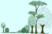
I can still be surprised. A walk on the Bogle Crag Trail in Grizedale Forest Park (2447ha) in Cumbria topped out at a viewpoint (235m) that had an uncharacteristic scene for Britain - in all directions, the landscape was clothed with trees. There were bands of broadleaf ancient woodland on the lower slopes of the valley that bisects the forest, rising up through conifers to the occasional bare ledge of a crag on the saddle tops. Behind these but merging well into the scene were some of the major lakeland peaks: the Old Man of Conistion to the W, and perhaps further away Scafel Pike and Helvelyn. Standing tall and bare of trees, these peaks were above an imaginary, natural “treeline”. This was far from an ugly view of a large, upland conifer plantation. The woodland clothed the landscape fully, as though nature had put it there. There weren’t the sharp boundary lines, the abrupt transition from the emerald green of plantation edges that so mar many upland views. And there were the openings in the forest where crags formed rock ledges that had no trees and from which clear views could be had. Learning about Forest Habitat Networks This was a breathtaking landscape view that I associate more with the national forests and parks of N. America, and with the much more highly wooded landscapes of eastern Europe and Scandinavia. It was, however, not by chance that I had fetched up in Grizedale, as there was a reason for my seeking out areas with greater woodland coverage. Earlier this year, I went on a training course on Forest Habitat Networks (FHN) at the Snowdonia National Park Environmental Studies Centre (1). I wanted to learn from the experts themselves – George Peterken (the originator of the FHN concept), Keith Kirby (Natural England) and Jim Latham (Countryside Council for Wales) - how linkages can be made in an ecologically coherent way to reverse the fragmentation of our natural landscapes. I potentially saw this as an interconnection network between the new, core areas of wildland that I advocate (see Mountain lions and eagles - the place of humans in nature (2)). While the basic principle is to use new woodland as linkages between existing habitats, I soon learnt on the course that there were many ways to approach improving connectivity in our farmed landscapes. In landscape exercises, we were encouraged to use strategies that reduced and overcame the barriers or resistance to movement of wild nature. Thus a ploughed field would have the greatest resistance and least permeability for many species, plant or animal, with improved and then unimproved grassland having increasingly less resistance. Adding field margin strips of un-ploughed land with native plant cover would reduce resistance, and increase connectivity if these strips were then networked with other land covers of lower resistance, such as unimproved grassland, or which linked in to existing patches of semi-natural habitat such as heath, scattered trees, scrub or woodland. Margins would also be an important approach to river corridors, where fencing off livestock from river edges would allow more varied landscape cover, and prevent erosion and silting into the river course (read about a real example of this - (3)). River (riparian) courses were routes for connectivity in themselves – we often overlook that many plants and trees distribute themselves by shedding seed in water courses, or bits of root breaking off and lodging further down stream (think of the dislodged bulbs of wild garlic). But riparian courses are also valued as corridors for new, narrow bands of woodland planting either side, especially if they could link into existing woodland cover. We did identify locations for new blocks of woodland in open landscape along our network linkages, although these were subject to a limit on how much land we could take up without necessarily reducing overall farming productivity. In some locations, where woodland backed onto arable land, we could offer a measure of protection to the existing woodland by creating buffer margins around the woodland to move away any harmful agricultural activity (such as from spray drift). As we squiggled away on land-cover maps (Phase 1 surveys), finding the optimum routes for linkages, and mixing up our approaches to suit, we began to see not only how wildlife but also people could navigate these new landscape features. Field margin strips doubled as hacking corridors for horse riders that could effectively open up large riding areas. But my vote was always cast on finding scope for new, riparian woodland with existing footpath access, because that is where I love to walk. This “least cost” (least resistance) to landscape movement/connectivity in the Forest Habitat Networks approach has been turned into a large scale technical exercise in mapping the potential forest habitat networks across both Scotland (4) and Wales (5) and awaits a widespread application in England (6,7). We were shown extensive maps of habitat networking for Wales that also used heathland and unimproved grassland as the network linkages, broadening the concept of habitat connectivity, but it is the use of forest habitat network maps that has had the most use so far in identifying potential. It’s a good way to pick up the gaps that should be a priority in linkage, but also shows the potential associations at landscape scale between currently isolated or fragmented habitats. This is already being used for targeting funding for woodland creation under Woodland Grant Schemes. It will increasingly be seen to inform the landscape policies in regional spatial strategies and also in regional biodiversity strategies (see for instance (8,9)). One thing that became clear on the course was that creating new Core Areas is not "value for money" in terms of increasing connectivity. Thus the effort put in to filling in the gaps between existing woodland blocks to create larger areas has a low priority compared to say creating narrow bands of woodland planting as network linkages between the blocks. This is the pragmatism that prevails when dealing in the predominantly farmed landscapes of Britain, and why the Wildlife Trusts lean heavily on this in their Living Landscapes projects as they move their influence from outwith their small nature reserves (10). It is a mitigation of farming rather than a removal of its pressures. It goes along with the presumption, and reality in most places, that the matrix through which the networked linkages are formed is predominantly an open landscape, and it is the hostility of this open matrix in between habitat patches that needs bridging by the network linkages. The matrix inverted from open to closed On our day out on field trips on the course, this was the state of the landscape that we first visited and discussed for its network potential. We were S of the Trawsfynydd Reservoir, in a wet, treeless sheep wasteland only relieved in the distance to the W by the scattered trees and “treeline” scrub below the crags of the Rhinog Mountains, and to the E by the hawthorn “savannah” on low hills. Our next stop was at Ty'n y Groes at the edge of the Forest of Brenin, a Forestry Commission plantation of 3,750ha. This was a much more closed landscape alongside the River Eden, the conifer of the Forestry Commission plantation rising up on its eastern side, the narrow plain of improved pasture of the National Trust tenanted farm to the western side, which then rose up through ancient oak woodland. The contrast could not have been greater. The matrix at our first stop was the predominantly open landscape of the wetland desert, the potential network linkages being new willow carr, bog myrtle, and riparian woodland eventually linking up to the scattered trees and scrub below the Rhinogs. Here, at this second stop, the matrix was inverted, to a closed landscape of predominantly woodland and where the network linkages could be new, fenced off field margins of unimproved grassland along the riparian corridor. It reminded me very much of the highly wooded farm landscape of Slovenia, where there is 60% woodland cover overall, and where the matrix is thus woodland and the network links are clearings for horticulture, hay making and grazing (see An Imagined Landscape (11)). In the final workgroup exercise, we were given a 10km x 10km area centered around Shap in Cumbria, and with some fictional landowners and their views on intervention for nature. Along with all our squiggling on the map, we were given “budgets” for woodland, field margin and river corridor work. The big and costly prize in terms of our budget was, to my thinking, being able to negotiate extensification of a large area of fell through removing sheep from it. That was the closest we got to “re-wilding” a putative core area (the presumption would be that it would scrub up), and we didn’t really have a context for it once we had achieved it. This was a lost opportunity that could have explored the policy implications for re-wilding since there had been evening talks given by Keith Kirby that had looked at the opportunities and drivers for large scale conservation, and on re-wilding as an option for new wildland in Britain. Keith seemed to think that there is only a likelihood of one large Core Area in each of Scotland, Wales and England. I asked him for his choice of location in England, and he suggested the southern Lakelands – a swathe running SW to NE from Grange-Over-Sands up to Kendal, or around Haweswater. But wherever it was, the likelihood would be that it would be a large upland/semi-upland reserve. The area of fell that we had gambled our resources on achieving extensification was near Haweswater, and so that location made sense, but I knew nothing about the other. However, within weeks of the FHN course, I was at a Natural England workshop to test develop scenarios on the uplands that would be used as tools to flesh out their Future Landscapes policy (12). John Gorst, Biodiversity Officer for United Utilities in the Lake District, was in my workgroup, and so I asked him if there were good reasons for Keith’s other choice. He said the area had extensive woodland cover (mostly native); a highly educated community; a good riparian system; few landscape designations; and the geology was an extension of the Morecambe Bay limestone. The Ordinance Survey map confirms the high proportion of woodland cover and the extensive system of water courses and tarns. The woodland cover is probably not up to the 40% level of somewhere like the Surrey Hills AONB (13) but traveling through its landscape, as I did recently, does often give the impression that the matrix is woodland, and not open landscape (the average woodland cover in England is only 8%). Like the Surrey Hills, there are some larger areas of woodland as well as numerous smaller patches of woodland, giving rise to that elusive mosaic of habitat on a landscape scale that conservationists exclaim for their much smaller managed landscapes, but in reality they are not very good at achieving. This area thus has great potential for identifying existing habitat network connectivity, and for filling in the gaps. How open were European primeval forests?
It would be interesting to see how the local
population in this southern Lakeland area would commit to the FHN concept
and incorporate more network linkage elements. But it would be even more
interesting to see how further they would go in embracing an increasing
extensification, recognising that the landscape around them was uncommon
in Britain, and because of the high woodland cover was some way onwards
towards the composition of what many take to be a wild landscape. The
latter is not however a view shared by many in the conservation industry.
It is hard to engage conservation professionals in discussion about the
nature of wild landscapes. Theirs is a commitment to predominantly open
landscapes as it offers the greatest response in maximising species
diversity and number counts as a result of their management action.
Without much analysis, they take these managed open landscapes as being
indicative of the natural order. Prof. Bill Sutherland, writing on habitat
management in his Conservation Handbook, perhaps speaks
for them all when he says (14):
This is the idealised view that disavows
that the matrix in Britain could ever be woodland. He then reveals what to
me is the systemic fault in the British approach to nature conservation: Well, yes, this gives a justification for maintaining the status quo, but what does this say about the relative openness in landscapes and the relative importance of open landscape species? How many chalk grassland butterflies should there be in a wild state when it is likely that it is an over-represented, artificial habitat (see Harting Down - obsession with conserving man-made landscapes (15)). Is the true natural state of a wild Britain a matrix of predominantly open landscape? Why do most of the countries in the rest of Europe have four to five times the woodland coverage that we have in England? Sutherland, writing in 2000, should have waited a few years before enlisting the work of Vera to substantiate his arguments, and there are many who still cling to it in spite of the critique it has attracted, including from Keith (see 16). Vera suggested that large herbivores determined and controlled primeval forest structure and composition, creating a predominantly open landscape matrix, a wood pasture landscape of grassland with scattered trees (17). He based his ideas on various paleoecological evidence, and on contemporary observations. In particular, he noted that oak regeneration only occurred outside of closed forest but that the fossil pollen preserved in peats and lake deposits was ubiquitous. John Birks subsequently produced a review of the use of paleoecological evidence for fossil tree pollen, noting that there should not be any assumption that ecological tolerances of species have not changed through time (18). Thus he repeated the point made by Oliver Rackham, that the relatively recent introduction of American oak mildew into Europe probably results in oak seedlings today having a greater light demand than in earlier times. Birks also points to the study of Mitchell, who used pollen-analytical data reflecting two different scales of spatial resolution to test the wood-pasture hypothesis (19). Both data sets indicated that the hypothesis should be rejected and that open-canopy forest only developed as a result of human activity during the past 3-4000 years. The ecological or evolutionary legitimacy of grazing Birks was clear that Mitchell’s work casts serious doubts on the relevance of the wood pasture model in the primeval landscape of temperate Europe and hence on the conservation management policies based on this model. The fashion in the conservation industry is to assume that aurochs, the wild cattle forerunner, now extinct in Europe but which overlapped with the introduction of livestock cattle, can be substituted in contemporary landscapes by some of the less, over-bred domestic cattle of today as a means of applying herbivore pressure through conservation grazing (see The craze for conservation grazing (20)). Here, the conservation industry has conveniently re-clothed their long-standing, synthetic agricultural practice with this new sheen of justification, but without considering the evidence.
The stable isotope composition of fossil
bones from aurochs and domestic cattle from a number of English Neolithic
and Bronze Age sites have been compared, and a difference in isotope
content has been found that the authors note suggests a different grazing
pattern between the two animals (21): In addition, a comparative analysis of the habitat of the extinct aurochs and other prehistoric mammals in Britain tested the hypothesis that the habitat of the extinct aurochs was primarily riverine flat-lands (22). It was found that the distribution of fossil bones of beaver had a strong association with the presence of lakes in the landscape; those of brown bear and wolf with the presence of cliffs and rock outcrops; and those of aurochs with the absence of woodland and with lower elevation and greater flatness. Both these studies cast doubt that aurochs would drive a landscape to substantial openness by destroying woodland. As Keith has argued, the issue is not about whether open conditions existed, but what extent they had in the landscape (16). Aurochs may only have maintained open the areas that were naturally low in woodland cover. Areas in a woodland matrix away from there, and that were opened by other means (natural disturbances of wind, fire etc.) were more likely to have been maintained open by the browsing of deer. Moreover, the wet marshland and riverine flat-land preference of aurochs was probably mediated by a disinclination to confront predators such as the wolf. The aurochs was much larger than today’s domestic cattle, and it is unlikely that they would have been taken down by wolves, but their behaviour and distribution would nevertheless have been influenced by predators. In light of this, David Bullock has argued that semi-domesticated cattle populations have "little ecological or evolutionary legitimacy in driving contemporary landscapes without also introducing predators" (23). As well as behaviour, there is also uncertainty about the number of aurochs in Britain prior to the introduction of farming, but Derek Yalden has come up with an estimate for all wild mammals in Mesolithic Britain of 535 million and with a biomass of 300,000 tonnes, made up mostly from the larger animals such as aurochs, moose, roe and red deer, and wild boar (24). Today, the estimate is that the number of wild mammals is less than half at 222 million, but that their total biomass has dropped to a fifth, at 61,000 tonnes. This reflects the loss of so many of the larger mammals to extinction that there used to be when the countryside was clothed in a woodland matrix 6,000 years ago, such as moose, wild boar and aurochs. The introduced species that have become feral, like the rabbit, brown hare, goat and the non-native deer, add a further 57 million and a biomass of 68,000 tonnes, roughly equivalent to that of the native wild animals today and signalling their significant impact. To the wild and feral mammals of today, we must also add the estimate for people and domestic livestock that collectively number around 65 million (21 million breeding sheep, 4 million cattle, 0.8 million pigs, 0.75 million horses and 38 million adult humans) but contribute a whacking 98% of the total mammalian biomass (about 6.6 million tonnes) with the domestic ungulates contributing 56% and humans 44% (25). Thus astonishingly, the biomass of the introduced domestic mammals is over 10 times greater than that of the wild mammals of 6000 years ago. Add to that the biomass of so many humans now (there may only have been 50,000 back then) and it is over 20 times greater. This massive amount of modern biomass comes at a price to our landscapes, forcing it to be artificially maintained in predominantly open landscapes so that it can sustain such a level. It leaves little space for the native wild mammals that we do have left, and it is a measure of how enormously we have changed the ecology of Britain. Remember that, the next time you see another of those conservation projects extolling the virtues of reintroducing a grazing pressure with those cute Highland cattle. Mark Fisher 30 June 2009
(1) Forest Habitat Networks - Developing New
Wildlife Friendly Landscapes, Snowdonia National Park Environmental
Studies Centre
(2) Mountain lions and eagles - the place of
humans in nature, Self-willed land February 2006
(3) Powys farmer helps fish and wildlife
thrive, Environment Agency News release 26 March 2009
(4) Scotland forest habitat network, Forest
Research
(5) Woodland habitat networks for Wales,
Forest Research
(6) Planning for biodiversity – opportunity
mapping and habitat networks in practice: a technical guide, English
Nature Research Report 687, 2006
(7) England Habitat Network Information
Note. Natural England Internal Briefing Note, 2007
(8) The Yorkshire and Humber Plan, Regional
Spatial Strategy to 2026, GOYH May 2008
(9) Yorkshire and Humber Regional
Biodiversity Strategy, Yorkshire and Humber Biodiversity Forum January
2009 (10) A Living Landscape, Yorkshire and the Humber: the ecological network approach to rebuilding biodiversity for the 21st, Yorkshire Wildlife Trust May 2009 www.ywt.org.uk/_filestore/File/Living%20Landscapes/090518%20-%20Living%20Landscapes%2009.pdf
(11) An Imagined Landscape, Self-willed land
September 2004
(12) Future Landscapes, Draft policy for
consultation, Natural England 2009
(13) Woodland, Surrey Hills AONB Landscape (14) The Conservation Handbook: Research, Management and Policy. William J. Sutherland, Blackwell Science, Oxford, UK, 2000, ISBN 0-03-205344-5 http://books.google.co.uk/books?id=KGP6qZK57mcC&pg=PP1&dq=the+conservation+handbook
(15) Harting Down - obsession with
conserving man-made landscapes, Self-willed land November 2007 (17) Grazing Ecology and Forest History, Vera, F.W.M. (2000) CABI Publishing
(18) Mind the gap:
how open were European primeval forests? Birks, H. John B (2005) Trends in
ecology & evolution 20, 154-156
(18) How open were
European primeval forests? Hypothesis testing using palaeoecological data,
Mitchell, F.J.G. (2005) J. Ecol. 93, 168–177
(21) Where the
wild things are: aurochs and cattle in England, Anthony H. Lynch, Julie
Hamilton, Robert E.M. Hedges (2008)
Antiquity, 82,
1025-1039
(22) A comparative
analysis of the habitat of the extinct aurochs and other prehistoric
mammals in Britain, Stephen J. G. Hall (2008)
Ecography - Pattern & Diversity in Ecology 31, 187-190 http://88.208.205.92/index.php?option=com_content&view=article&id=250&Itemid=283 url:www.self-willed-land.org.uk/articles/open_closed_matrix.htm www.self-willed-land.org.uk mark.fisher@self-willed-land.org.uk |